


 English
  Français
Utah
You can click on pictures to enlarge them
Moab
It is a typical small town, young and dynamic. The city center is very nice. We chose to stay there to resume the visit of Arches National Park we started three years ago. To join it from Monument Valley, we stopped at Mexican Hat, amazing rock with the shape of a Mexican Hat, as the name suggests. It also gave its name to a whole village in the middle of nowhere.
Beyond the proximity to many remarkable sites which make it a conveniently located stopping-off point, Moab has much to offer for a short stay: its streets are very welcoming, its restaurants and cafés are nice and its souvenir shops are amazing and funny. Sports shops are not forgotten: indeed, there is a long-standing tradition in Moab for mountain biking and rafting. Besides, you feel its inhabitants are very close to nature.
At the supermarket, the choice at the food section is considerable. You can compose your own salad, as well fruits as vegetables: numerous stalls to the fresh food department are at your disposal and you fill your carton as you like.
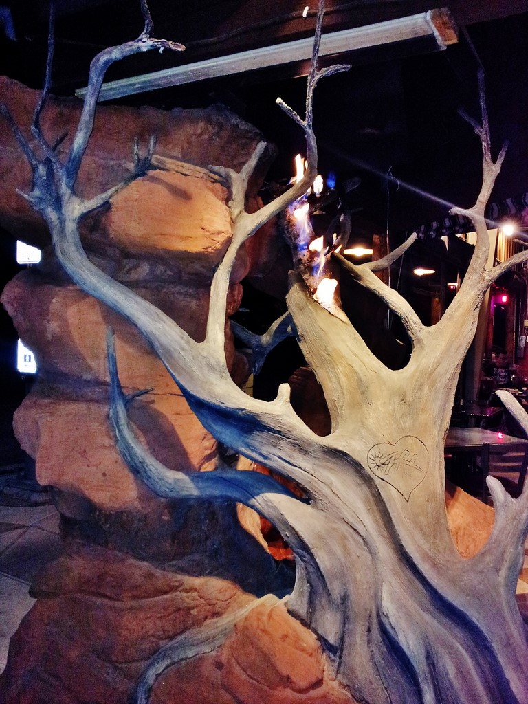
Like we did in 2013, we ate at the restaurant Zak Pizza (photo) on Main Street. Dishes are high-quality, notably wood-fired pizzas, red meat and desserts. The decoration is really nice.
For all those reasons, we greatly recommend a stop at Moab to those who wish to visit the national parks of Utah.
And the cherry on the cake... we had the chance and the privilege to meet Miss Utah and say hello to her! She was walking along Main Street with her two bodyguards for short courtesy visits in shops, bars and restaurants.
Arches National Park
It is a small surprising park which groups together the largest concentration of natural arches in the world, molded in magnificent red sandstone, of all sizes. Some exceed 80 meters range. A tarred road about 23 miles long runs across the Park from North to South. Most of those arches are easily accessible by car or after a 15 minute walk. The most famous are Landscape Arch, a 90 meters long rock strip over a sandstone amphitheater, Double Arch, and Delicate Arch, which became the idealized image of Utah that appears on license plates of the state. There are also other amazing rocks: suspended rocks (like Balanced Rock), fairies chimneys, and vertiginous red cliffs.
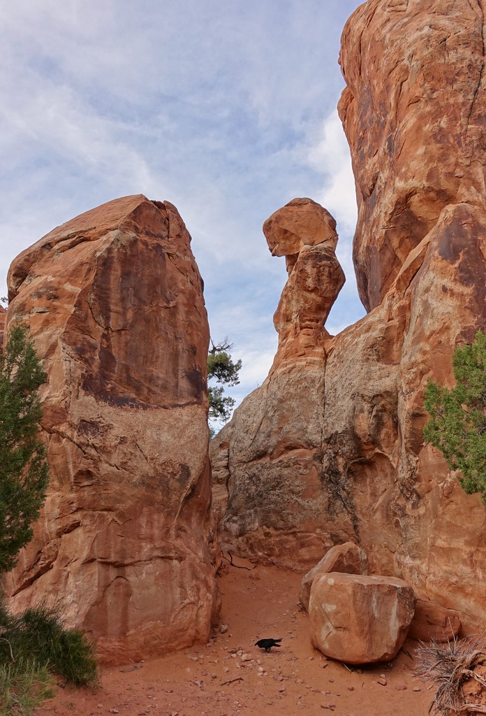
This year, we visited a different place in the park, located in the North. We made the Devil’s Garden Trail (photo), a hike classified as hard. 11.5 kilometers long, it groups together eight arches, notably Landscape Arch, one of the biggest in the world, which is however surprising in the thinness of its outline. It is dangerous and prohibited to get close to it because of falling rocks.
Double O Arch is very singular: it looks like a huge «8» carved in red stone. The landscapes you walk through are fantastic, but you got to earn them. Some parts are rather hard, sometimes vertiginous. The heat may be an additional difficulty. Usual precautions during desert areas crossings apply naturally. Do not hesitate to provide yourselves with a map (available at the starting-point of the trail) not to get lost. In any case, follow strictly cairns, those small mounds of stone easily recognizable.
Near the end of the trail, our friend saw a rattlesnake, which reminds us we also have to be careful with that. Fortunately, they are rare and they only attack when they are really assaulted.
After so many efforts, we had a picnic while admiring a beautiful sunset. And then we went for the same hike on the way back, under a deep night sky filled with stars, provided with our flashlights. That trail was spectacular and memorable.
Cedar Breaks National Monument

Like Red Canyon, that modest park is nicknamed «Little Bryce» because of its similarity with Bryce Canyon. Indeed, it is a natural amphitheater with red, orange and ocher colors made of hoodoos. Fir trees bring some greenery that contrasts perfectly with the warm tints of the rock formations, to which some Bristlecone pines - known for their longevity and their resistance - cling firmly. A nearly 8 kilometers scenic road run along the cliffs and offers beautiful viewpoints. Located more than 3000 meters high in the heart of the Dixie National Forest, we found there a bit of coolness on the road from Moab to Hurricane, overcome by the heat. There were even remains of snow, which gave the place a captivating beauty.
Zion National Park

The «Celestial City of God» - name given to the park by the Mormons - is a must-visit. The majestic spectacle of the huge sandstone cliffs, the very special color scheme according to the time of day, and the beautiful contrast between the rocks’ warm tints and the bright green of maple trees and ash trees woods that line the Virgin River make it a unique place. Its archaeological richness is remarkable: some of its ruins date from the prehistoric era. It has many viewpoints that offer a breathtaking panorama. It is divided in two parts: Kolob Canyons in the North and Zion Canyon in the South. The last mentioned is the most visited. It is the starting-point to many hikes.
Finally, the undeniable originality of Zion is that you start the visit of that park from the ground in the heart of deep valleys to achieve it on top, at the cost of efforts that are worth because the reward is a unique view of the whole site. That sets it apart from most of the other parks in Western America, where it is the opposite.
You cannot drive your own vehicle there. You leave it on the wide Visitor Center parking to use the free shuttle service. They operate on solar energy captured by photovoltaic panels on their roof. The last stop is near the beautiful Sinawawa Temple.
We got off at «The Grotto» station to hike up the Angels Landing Trail (photo), a tough hike with a difference in altitude of more than 400 meters, and above all an 800 meters long end of trail on a narrow and steep mountain ridge. A chain system has been installed to grip if necessary. Inadvisable for persons who have problems of dizziness!..
We woke up very early to avoid the sweltering heat. We brought a lot of water, fruits juice, cereal bars and some fruits. We started the hike as the sun began to rise. The temperature was perfect and we had immediately a sense of well-being; the splendid panorama and the pleasant atmosphere helped. Other hikers were already there, which brought a contagious good humor.
We realized quickly that the trail increased in difficulty to get really physical. The slope was steeper and steeper. The height was the very abrupt part with its series of 21 very tight bends. However, wonder outweighed tiredness for the landscape was amazing. Even though shade predominated because of the very deep aspect of the site and the sun still low, the magic happened.
Then came the last part: the most dangerous. That rocky ridge with the drop on each side requires the greatest vigilance and a total self-confidence. You should never embark on it if you do not feel it. It is true that the sign with the symbol of the hiker slipping over the drop - with the announcement of death tolls the last past years - casts a chill. But it warns clearly visitors about the potential danger. We saw a young hiker go and do some recon, and then she came back and gave up definitively because she felt unable to do it. She preferred to stay and wait for her friends down the ridge on Scout Lookout, where the view is already breathtaking. That was a wise decision.
We were self-confident so we embarked on it. It was necessary to grip the chains most of the time, but we did not have major technical difficulties. It was just physical, and we had to be careful all along, especially when we crossed people coming down. The most delicate part is the one where the rock is barely one meter large. Fortunately, it is very short. Obviously, we must be even more vigilant and grip the chain tightly.
It took J.R. and I one hour and a half for the climb. Our friend took more time because he took more pictures and filmed some scenes with his camcorder, notably a couple who performed acrobatics in duet in the heart of that spectacular setting. On top, the vertiginous view on almost all of the Zion Park was extraordinary. Numerous cairns were set on a slightly sloping ground, as if they had been arranged there to welcome and congratulate every hiker who made it until the end. The sun was higher and it was beaming on the dense greenery, which freshness contrasted with the warm tints of red and cream-colored rocks, and the sober white rocks. The Virgin River - dried up in some places - meandered in the heart of that fabulous landscape. We were between relief and wonder. That moment was magical.
So we lingered to enjoy those special moments in that idyllic place. The contagious good humor between hikers showed, even more because there was in addition that great satisfaction and that enormous pride in having hiked up the Angels Landing Trail until the end. Young chipmunks did the show: they were not wild at all and came to eat out of our hands. One of them climbed on my back, and another one got straight out into a couple’s half-open back-bag to steal food from them!..
And then came the time of the descent, as the heat started to increase. It also took J.R. and I one hour and a half. Indeed, it took us the same time as the climb because it is the most dangerous: it is harder to stand on your feet as you are coming down, the more as sand and/or dust on the rock can make it slippery. We were more in restraint and extreme vigilance, especially along the ridge. Moreover, we lingered at the 21 bends to admire and photograph a rattlesnake comfortably coiled under a rock.
Once we achieved the trail, we turned around for one last time to admire at length that site - especially that top where «angels land» according to its name - already feeling nostalgic. We were really proud for having hiked up a trail classified as one of the 10 most dangerous in the world, but above all we felt happy for having visited that park with a breathtaking beauty. Because we should not lose sight of what is essential.
Published on October, 28th 2017
